
Specialist
for GIS solutions
We design, develop and implement
comprehensive GIS solutions.
Selected projects
We believe that the essence of the success of any project is the ability to create and transform the customer’s vision into a sophisticated GIS solution.
ZBGIS Map Client web application
Accurate digital map of Slovakia including various spatial and topographic data.
Map services for the ESKN information system
The information recorded in the Land Registry forms the basic information base for legal transactions.
GIS integration to the Address Register
Central data source containing addresses and registration numbers of all buildings in the territory of the Slovak Republic.
Information system List of buildings
It is used for communication between municipalities and the Land Registry and for collecting selected data on buildings.
Map application for IS for data collection and analysis of the economic environment of the capital city Prague
The solution is not tied to software licenses and does not limit the number of users.
Monitoring of accused and convicted persons
The app facilitates the work of dozens of probation officers every day.
We build individual relationships with our customers
We have completed dozens of successful projects and integrations with our customers. We use agile development methods to ensure that the customer is a constant part of the GIS solution and that the work is always moving in the right direction.

50 M
In one day all cyber attacks in the world

9 trillion USD
The value of cyber damage

30 %
Increase of cyber attacks compared to last year
Analyses
-
Analysis of the current state of existing customer information systems.
-
Analysis of existing data and data sources, analysis of data quality and data linkages.
-
Analysis of customer needs and processes, creation of process diagrams and analytical models to identify current weaknesses.
Solution architecture design
- Design solutions for efficient data creation, data quality control or topological rules control during data creation.
- Design of solution functions (creation of reports, views, electronic services, etc.) to integrate the solution with customer information systems.
Development
- Development of software solutions – programming of geographic information system in cooperation with the customer. Using agile development methods, the customer becomes part of the solution creation. It monitors and comments on every stage of development and the work always evolves in the right direction.
Deployment
- Deployment into production as the next step in the GIS implementation process.
- User training and process setup for proper use of the new information system.
IT infrastructure management and monitoring
- Server and network management.
- Manage the functionality and security of systems.
- Monitoring system availability, functionality and performance, troubleshooting.
Support
- Ensuring functionality and availability of services through product support and solution operation support.
- As part of the service support, ongoing consultation by the customer.
Stay up to date
Latest Articles
-

We create GIS solutions that the world appreciatesTest article
Read article: We create GIS solutions that the world appreciatesTest articleThe ZBGIS map client has been providing full-value information from the Department of Geodesy, Cartography and Cadastre for several years.…
-
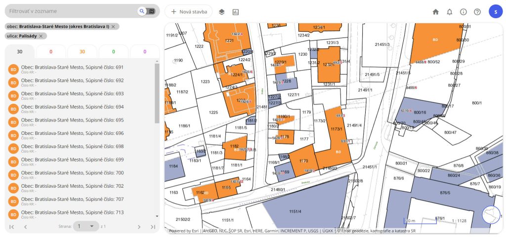
5 interesting facts about the Inventory of Buildings
Read article: 5 interesting facts about the Inventory of BuildingsThe Office of Geodesy, Cartography and Cadastre of the Slovak Republic (ÚGKK SR) operates the application “Information System List of…
-

ZBGIS digital map makes life easier
Read article: ZBGIS digital map makes life easierThe ZBGIS Map Client web application, which Zymestic has been creating for its partners for many years, is a very…